Kouri Island: The Bridge, the Beach and How to Spend Two Hours There
A 1,960 m bridge over shallow turquoise water, a beach right at its foot, and Heart Rock on the north shore. Where to park, whether you can swim, what closes the bridge in a typhoon, and a simple two-hour plan.
- Time needed
- about 2 hours, our suggestion
- Bridge
- 1,960 m (about 1.2 miles), opened February 2005
- Free parking
- the viewpoint at the south end of the bridge (official)
- Swimming
- a swimming area on the west side of Kouri Beach
- Typhoons
- the bridge closes when winds reach 25 m/s under a storm warning
- Best time
- a calm, sunny day


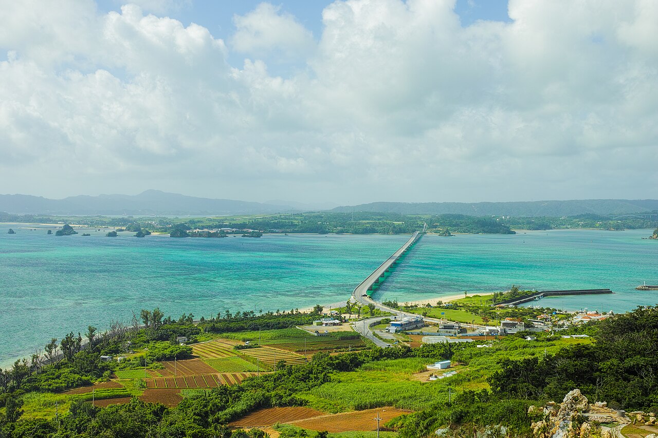
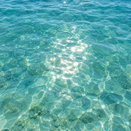
You pull into the viewpoint lot at the south end of the bridge and step out. Ahead, a two-lane road runs straight out over the sea for 1,960 meters, and on both sides the water over the coral reef shifts from pale green to deep blue. At the far end sits Kouri Island, a low, rounded island in Nakijin Village.
Kouri Island (古宇利島, KOH-oo-ree) lies off the north of Okinawa's main island. The local tourism association counts the bridge view among Okinawa's signature sights, and the island is an easy add-on to a day at the Churaumi Aquarium. This guide covers the bridge, the beach at its foot, swimming, typhoon closures, parking, and a two-hour plan.
- Travelers driving the north on a day trip
- Families who want an easy beach stop
- Photographers chasing the classic bridge-over-turquoise shot
- 1,960 mLength of the Kouri Bridge (about 1.2 miles)
- 2005Year the bridge opened (February)
- ~300 mSand on the west side of Kouri Beach, with a swimming area
- 25 m/sWind speed that closes the bridge under a storm warning (about 56 mph)
As of October 2026, Nakijin Village Tourism Association and Okinawa Prefecture
The Kouri Bridge
The bridge links Yagaji Island, part of Nago City, to Kouri Island. The bridge opened in February 2005. Before that, people reached Kouri by ferry from Unten Port, according to Nakijin Village.
The Nakijin Village Tourism Association calls it the longest bridge around Okinawa's main island (on its page last updated in March 2021). The association's page doesn't mention a toll.
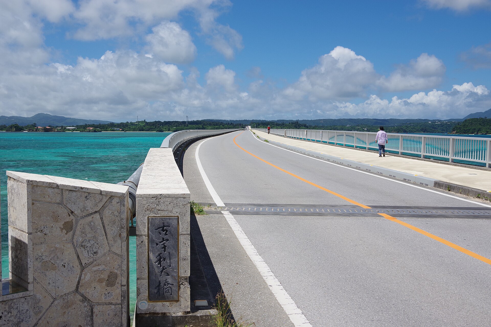
Walk part of it. The association suggests parking at the free lot at the viewpoint at the south end of the bridge, on the Yagaji side. From there, walk about 500 m (about a third of a mile) onto the bridge and come back. Walking the full length takes more than 20 minutes each way, it notes (as of October 2026, official site).
Driving over it. For photos, use the viewpoint lot or the beach rather than stopping on the bridge. New to driving here? Read our guide to driving in Okinawa first. Cars keep left.
Kouri Beach
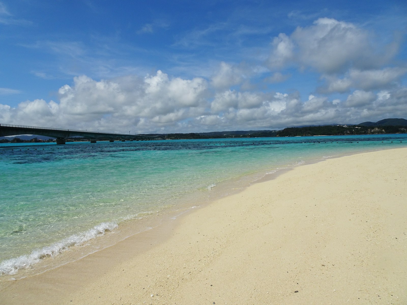
Kouri Beach sits at the island end of the bridge, and the bridge splits it into a west side and an east side. You can walk between the two by passing under the bridge (as of October 2026, official site).
- West side: the main beach, with about 300 m (about 330 yards) of sand and a swimming area. The association says it fills with swimmers in summer.
- East side: smaller and usually quieter, a better pick if you just want to sit by the water.
Parking, showers and toilets. The beach listing gives parking for 150 cars. Toilets and paid showers are at the parking area of Kouri Fureai Plaza (古宇利ふれあい広場), a few minutes' walk from the beach, along with shops and a restaurant (as of October 2026, official site). The parking fee and the shower price are unconfirmed — check the signs on site.
Swimming questions. For swimming at Kouri Beach, the association points to the Kouri Rural Environment Improvement Sub-Center at 0980-56-4909, on weekdays from 9:00 to 12:00 (as of October 2026, official notice from July 2023). Whether staff speak English is unconfirmed.
Can you swim?
Yes, in the swimming area on the west side. The swimming season, whether lifeguards are on duty, and whether a jellyfish net is set are unconfirmed — ask the sub-center above, or check the signs on site. Don't count on any of them until you've checked.
- Box jellyfish. Okinawa Prefecture runs a box jellyfish (habu-kurage) advisory from June 1 to September 30 (2026 dates). The prefecture's advice is to swim inside nets where they're set and to cover your legs.
- Stay inside the swimming area and follow any signs and staff on the day.
- Don't swim when the sea is rough or a warning is out.
If you want lifeguards and a net for sure, our beach comparison covers managed beaches that publish their season and staff.
Heart Rock and Tokei Beach
Two smaller spots sit on the north side of the island. Both are free to visit, according to the tourism association.
- Heart Rock stands on Tinu Beach (ティーヌ浜). It's two rocks that look like a heart from the right angle. The narrow base of each rock was cut by the waves over time. It became famous after appearing in a TV commercial in 2014. Parking for 20 cars is listed.
- Tokei Beach (トケイ浜) is just past Tinu Beach, split into two small coves by a little headland. Rocks around the headland have smooth round holes, called potholes, worn by nature over a very long time. The association says it's popular for snorkeling but has no lifeguards, so take great care. Parking for 10 cars is listed.
(all as of October 2026, official site; parking fees not stated)
The "island of the gods"
Nakijin Village describes Kouri as an island with a legend about the origin of people, and it's known as an "island of the gods." Traditional rituals are still held here, among them the Unjami sea festival. The village doesn't publish the dates on that page. If you come across a ceremony, watch quietly from a distance.
A two-hour plan
This is our own suggestion, built from the official facts above.
- 0:00Park at the free viewpoint lot at the south end of the bridge.
- 0:05Walk about 500 m onto the bridge and back, for the views on both sides.
- 0:30Drive across. Park near Kouri Beach and walk down to the west side.
- 1:15Drive to the north side for Heart Rock and Tokei Beach.
- 1:50Head back over the bridge.
Have more time? Swim in the summer, or stay for a late-afternoon light on the water before you drive back.
Getting there

By car. This is the easiest way. Most visitors pair Kouri with the Churaumi Aquarium and the Motobu Peninsula on the same day. The driving time from Naha is unconfirmed — the official access page shows it only as an image, so plan with a map app on the day.
By bus. It's possible, but slow. The Yanbaru Express Bus runs from Naha Airport to Nakijin Village Office in about 3 hours, according to the Nakijin Village Tourism Association. From there, the same company's 3 Islands Line goes over the bridge to Kouri Island.
- StartNago Bus Terminal-mae
Yanbaru Express uses its own stop named for the front of Nago Bus Terminal, not the terminal's numbered bays. Where exactly it is could not be checked on the official site (unconfirmed).
- Bus Airport Line (for Churaumi Aquarium / Unten Port)Yanbaru Express Busabout 57 minfare unconfirmed
More about this ride
Northbound buses go around the Motobu Peninsula (Motobu Port, the Churaumi Aquarium area) before reaching Nakijin Village Office, so the ride takes just under an hour (as of October 2026, official timetable effective Nov 1, 2025). The fare from Nago could not be checked: the official timetable lists fares from the airport only, and the official fare search did not show amounts (unconfirmed).
- Bus 3 Islands Line (Santo-sen), for Kouri IslandYanbaru Express Busabout 15 min¥400
More about this ride
Sorahashi is the first stop on Kouri Island. The bus then loops to Tokei Beach (Heart Rock) and Kouri Ocean Tower and back to Sorahashi. Some trips run on weekdays only. Allow for the wait at Nakijin Village Office as well: by the timetables it is roughly 10 to 40 minutes, depending on the bus, so the whole trip takes longer than the two rides added up. A Kouri Free Pass sold on board (1 day ¥1,000) covers the whole 3 Islands Line and the Airport Line between Nakijin Castle Ruins and Nakijin Village Office (as of October 2026, official timetable).
- Get offKouri Island no Eki Sorahashi
For reference only. Travel times depend on traffic, and routes and fares change. Check the operator's official site before you go (as of October 2026, official sites).
For more ways to tour the north, see Okinawa without a car.
Good to know
Sun. Bring water, a hat and sunscreen for the walk on the bridge.
When to go
Kouri looks its best on a calm, sunny day, when the shallow water shows its colors. Summer is hot: Naha's average high is 31.9°C (89°F) in July. The box jellyfish advisory runs from June 1 to September 30. Typhoons come most often in August and September, the two months with the most approaches, and that's when a closed bridge is most likely (Japan Meteorological Agency normals for 1991–2020).
From November to April, Naha's average highs are a cooler 19.8–25.0°C (68–77°F). It's a good time to walk the bridge and look at the water, even if swimming isn't on the plan. The rainy season usually runs from around May 10 to around June 21.
| Jan | Feb | Mar | Apr | May | Jun | Jul | Aug | Sep | Oct | Nov | Dec | |
|---|---|---|---|---|---|---|---|---|---|---|---|---|
| Avg high | 68°20°C | 68°20°C | 71°22°C | 76°24°C | 81°27°C | 86°30°C | 89°32°C | 89°32°C | 87°31°C | 83°28°C | 77°25°C | 71°22°C |
| Avg low | 59°15°C | 59°15°C | 62°17°C | 66°19°C | 72°22°C | 77°25°C | 81°27°C | 80°27°C | 78°26°C | 74°24°C | 69°20°C | 62°17°C |
| Rain | 4.0"102mm | 4.5"114mm | 5.6"143mm | 6.3"161mm | 9.7"245mm | 11.2"284mm | 7.4"188mm | 9.4"240mm | 10.8"275mm | 7.1"179mm | 4.7"119mm | 4.3"110mm |
| Typhoons | – | – | – | – | 0.4 | 0.6 | 1.5 | 2.2 | 1.9 | 1.1 | 0.3 | – |
| Rainy season | ● | ● | ||||||||||
| Box jellyfish | ● | ● | ● | ● | ||||||||
| Golden Kings | ● | ● | ● | ● | ● | ● | ● | ● |
- Typhoons: about 7.7 a year come near Okinawa, most in August and September. Flights and ferries can stop for a day or two — keep your plans flexible in late summer.
- Rainy season: around May 10 to around June 21 in a typical year.
- Swimming: Swim at managed beaches during their swimming season, when lifeguards keep watch and nets are set against box jellyfish. Many beaches have neither. Check the beach's official page before you go.
- Box jellyfish: advisory June 1 – September 30 (2026); most stings June to September; swim inside the nets and cover your legs.
- Basketball: B.LEAGUE season runs fall to spring, with playoffs in May.
- The nonstop: United's SFO–Naha nonstop starts March 27, 2027, three times a week. Some reports say it is seasonal; that is not confirmed yet.
Climate: Japan Meteorological Agency, Naha climate normals 1991–2020. Typhoons: JMA normals. Jellyfish: Okinawa Prefecture, box jellyfish advisory. Checked 2026-10-10.
Official info

- Nakijin Village Tourism Association — Kouri Bridge (Japanese)
- Nakijin Village Tourism Association — Kouri Beach (Japanese)
- Nakijin Village Tourism Association — access in English
- Yanbaru Express Bus — 3 Islands Line (Japanese)
Planning the rest of the north? Start with our Churaumi Aquarium and Motobu day trip.
Sources
- Nakijin Village Tourism Association — Kouri Bridge (official, Japanese)
- Nakijin Village Tourism Association — Kouri Beach (official, Japanese)
- Nakijin Village Tourism Association — Kouri Beach inquiries (official, Japanese)
- Nakijin Village Tourism Association — Heart Rock (official, Japanese)
- Nakijin Village Tourism Association — Tokei Beach (official, Japanese)
- Nakijin Village Tourism Association — Warumi and Kouri bridge gates in typhoons (official, Japanese)
- Nakijin Village Tourism Association — access for visitors from outside Japan (English)
- Nakijin Village — Kouri (Japanese)
- Okinawa Prefecture, Northern Civil Engineering Office — roads closed in severe weather (Japanese)
- Okinawa Prefecture — bridges reopened after Typhoon No. 18, Aug 26, 2026 (Japanese)
- Okinawa Prefecture — box jellyfish advisory (Japanese)
- Yanbaru Express Bus — 3 Islands Line timetable and fares (Japanese)
- Japan Meteorological Agency — Naha climate normals (Japanese)
- Japan Meteorological Agency — typhoon normals (Japanese)